Close Icon
Gear IconImportant Reminder:The Foursquare City Guide app officially sunset on December 15, 2024, with the web version following in early 2025. However, your check-in journey doesn’t end here! Join us on Swarm, where new adventures await.
Learn more
Reloading results...

Suggestions for Hiking Trail near Berkeley

Filters:
    • 8.6
      Trail
      Berkeley
      Save
      • Danielle H.

        Danielle H. • December 7, 2016A nice hiking trail and seems to be dog friendly. There are a couple of uphill spots but overall not too bad and the views are beautiful!

    • 8.6
      Trail
      Centennial Drive, just east of Memorial Stadium, Berkeley
      Save
      • Jason K.

        Jason K. • February 12, 2013it's very comfortable way to ride a mountain bike. best way to improve ur mountina biking skills..

    • 9.2
      Trail
      Stonewall Rd & Claremont Ave, Berkeley
      Save
      • cnelson ︻.

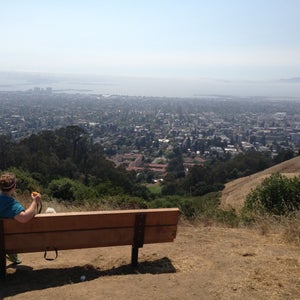
        cnelson ︻. • December 13, 2015Super Intense hike but the view from the top is worth it!

    • 8.4
      Trail
      Berkeley
      Save
      • Kimmy S.

        Kimmy S. • May 25, 2012BYOB(ags). Place is great alternative to PI esp on weekends!

    • 8.0
      Trail
      Frontage Rd. (btwn Ashby Ave. & Gilman St.), Berkeley
      Save
    • 9.0
      Trail
      Wildcat Canyon Rd, Berkeley
      Save
      • Pacific Union

        Pacific Union • September 4, 2013Best walk in the East Bay! This scenic lookout marks the start of the paved, stroller-friendly Nimitz Trail, an easy “hike” with shady spots. Great for family fun or impressing visitors with views.

    • 7.5
      Bridge
      I-80 (at Aquatic Park), Berkeley
      Save
      • Alex M.

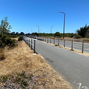
        Alex M. • March 2, 2012The bike/ped bridge connects the sf bay trail and Berkeley marina to downtown Berkeley, 6th st commercial dist. And the Channing way bicycle boulevard to downtown.

    • 7.3
      Trail
      Centennial Dr (at Stadium Rim Way), Berkeley
      Save
      • SF Weekly

        SF Weekly • May 25, 2011SF Weekly’s Best Of 2011 Winner – Editorial Pick – BEST PLACE TO RUN7.3 mi. trail offers dirt terrain, steep hills, & views of UC Berkeley's Campanile, Golden Gate Bridge, & Mount Tamalpais...

    • ?
      Trail
      El Cerrito
      Save
    • ?
      Trail
      Berkeley
      Save
    • ?
      Trail
      Berkeley
      Save
    • ?
      Trail
      Berkeley
      Save
    • ?
      Trail
      Oakland
      Save
    • Category icon
      ?
      Trail
      Berkeley
      Save
    • ?
      Trail
      Berkeley
      Save
    • ?
      Trail
      Berkeley
      Save
    • ?
      Trail
      Vine Street, Berkeley
      Save
    • ?
      Trail
      Oakland
      Save
    • ?
      Trail
      Berkeley
      Save
    • ?
      Trail
      Berkeley
      Save
    • ?
      Trail
      Save
    • ?
      Trail
      Berkeley
      Save
    • ?
      Trail
      Berkeley
      Save
    • ?
      Trail
      Berkeley
      Save
      • Ira S.

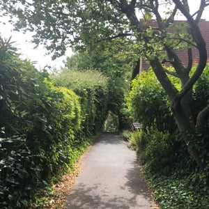
        Ira S. • September 29, 2013Tunbridge Lane - one of Berkeley's many paths and lanes. Check out BerkeleyPaths.org for a great map!

    • ?
      Trail
      Seaview trail (Tilden Park), Berkeley
      Save
      • David B.

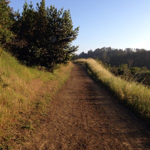
        David B. • November 12, 2010Breathe the air up there, though you're probably already heaving it in after that climb.

    • ?
      Trail
      Berkeley
      Save
      • Ira S.

        Ira S. • July 11, 2013Berkeley has dozens of paths like this one - check them out! berkeleypaths.org

    • ?
      Trail
      Berkeley
      Save
      • Jojo L.

        Jojo L. • January 30, 2012Short trail that will take you just far enough away from the city noise.

    • ?
      Trail
      Berkeley
      Save
      • Ira S.

        Ira S. • April 25, 2013Another wonderful path - check out berkeleypaths.org for more info

    • ?
      Trail
      Berkeley
      Save
      • Ira S.

        Ira S. • June 26, 2014BerkeleyOaths.org

    • ?
      Trail
      Berkeley
      Save
      • Em K.

        Em K. • July 7, 2013Steep. Good work out. Great views. Easy to get lost though. Trails look similar. There's an entrance off Tanglewood, but look for a street sign pointing to the path up a few concrete steps.

    • Don't see the place you're looking for? Add a new place to Foursquare.